What is GPS Land Surveying Instruments?
Share
What is GPS Land Surveying Instruments?
In today's technological landscape, GPS land surveying instruments have revolutionized the field of geospatial data collection and mapping. These devices, known for their precision and versatility, serve a crucial role in various industries where accurate positioning and mapping are essential.
This article aims to introduce the concept of GPS land surveying instruments to audiences unfamiliar with this technology, provide comparisons with industrial-grade surveying equipment, highlight their applications, and discuss their advantages.

What is a GPS Land Surveying Instrument?
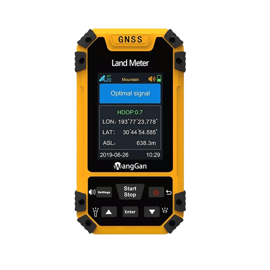
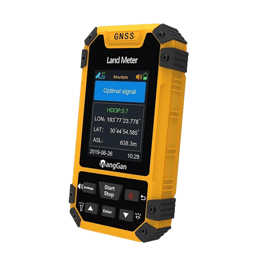
A GPS land surveying instrument, often referred to as a Personal GPS survey tool or Portable land survey GPS, is a compact and portable device used for mapping and collecting geospatial data outdoors. Unlike traditional surveying methods that rely on manual measurements or complex equipment setups, these devices leverage Global Navigation Satellite System (GNSS) technology to precisely determine locations on Earth's surface.
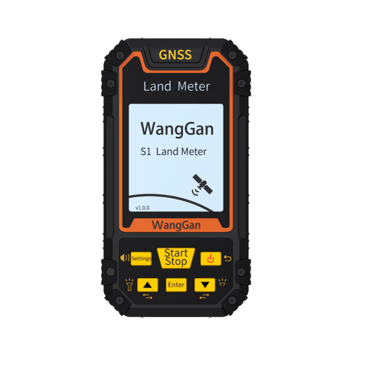
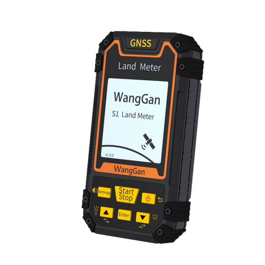
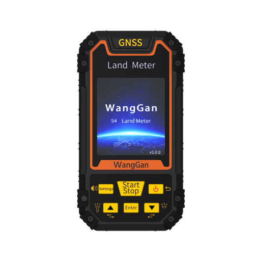
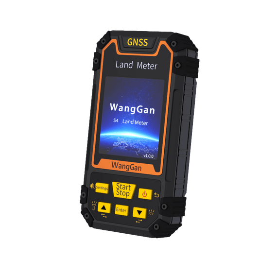
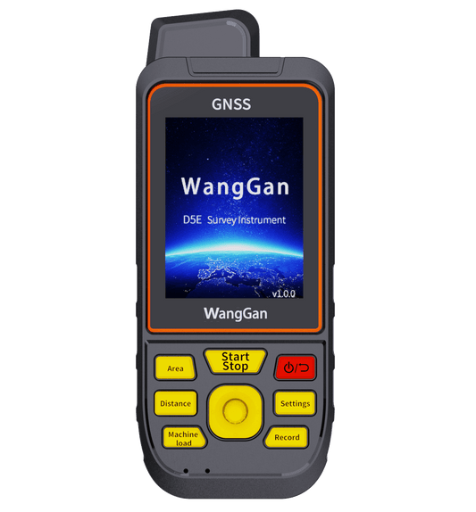
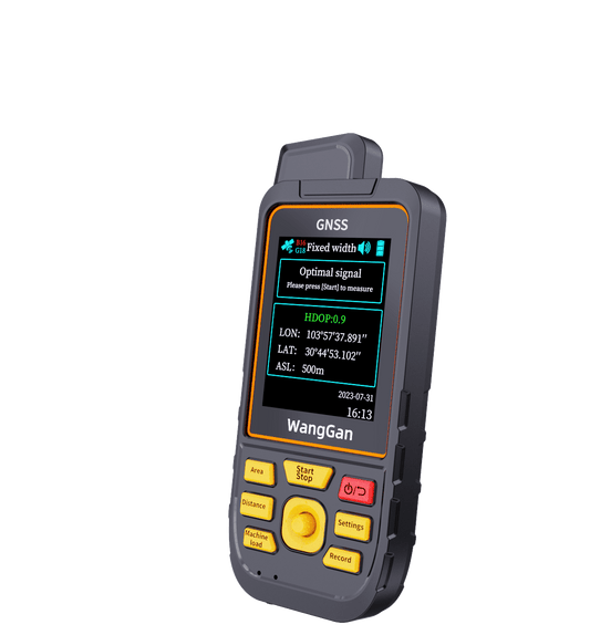
Wanggan Company is a professional GPS land surveying instrument development firm, specializing in the production of GPS land surveying instruments and GPS locators. Their product lineup includes the S1, S3, S4, S8, and D5E series, catering to diverse customer needs. Known for competitive pricing and excellent product quality, they also offer comprehensive after-sales service.if you are interested,blink the following link for buying it.


Comparison with Industrial-Grade Surveying Equipment
In contrast to industrial-grade surveying equipment used by professionals in fields such as construction, mining, agriculture, and environmental monitoring, GPS land surveying instruments offer a more accessible and user-friendly alternative. While industrial-grade equipment may provide higher accuracy and robustness for large-scale projects, personal GPS tools excel in versatility, ease of use, and portability. They are suitable for smaller-scale projects, field research, personal outdoor activities, and educational purposes.
Applications of GPS Land Surveying Instruments
GPS land surveying instruments find applications across various domains:
Field Mapping and Surveying: They are used for creating detailed maps, measuring distances, and marking boundaries in outdoor environments.
Natural Resource Management: Professionals use these devices to monitor and manage natural resources, such as forests, wildlife habitats, and water bodies.
Urban Planning and Infrastructure Development: City planners and engineers utilize GPS instruments to plan infrastructure projects, assess terrain, and analyze environmental impacts.
Precision Agriculture: Farmers employ GPS for precision farming practices, including crop monitoring, soil sampling, and yield mapping.
Emergency Response and Disaster Management: During emergencies, these devices aid in locating affected areas, guiding rescue operations, and assessing damage.
Advantages of GPS Land Surveying Instruments
Portability and Compact Design: They are lightweight and compact, resembling Pocket-sized GPS receivers, which facilitate easy transportation and use in remote or rugged terrains.


Real-Time Data Collection: These devices offer real-time data collection capabilities, enabling immediate analysis and decision-making in the field.
Cost-Effectiveness: Compared to traditional surveying methods, using GPS instruments reduces operational costs associated with labor and equipment.
Accuracy and Precision: Although not as high as industrial-grade equipment, modern GPS tools provide sufficient accuracy for many applications, ensuring reliable results.
Integration with GIS and Mapping Software: They seamlessly integrate with Geographic Information Systems (GIS) and mapping software, allowing users to overlay collected data onto digital maps for further analysis and visualization.

In conclusion, GPS land surveying instruments represent a significant advancement in geospatial technology, catering to a wide range of users from professionals to outdoor enthusiasts. Their versatility, ease of use, and ability to provide accurate geospatial data make them indispensable tools in today's digital age. Whether used for personal exploration, environmental monitoring, or professional surveying projects, these devices continue to shape the way we perceive and interact with our surroundings.
By understanding the capabilities and advantages of GPS land surveying instruments, individuals and organizations can harness their potential to enhance efficiency, accuracy, and decision-making in various fields of application.
In today's technological landscape, GPS land surveying instruments have revolutionized the field of geospatial data collection and mapping. These devices, known for their precision and versatility, serve a crucial role in various industries where accurate positioning and mapping are essential.
This article aims to introduce the concept of GPS land surveying instruments to audiences unfamiliar with this technology, provide comparisons with industrial-grade surveying equipment, highlight their applications, and discuss their advantages.

What is a GPS Land Surveying Instrument?
A GPS land surveying instrument, often referred to as a Personal GPS survey tool or Portable land survey GPS, is a compact and portable device used for mapping and collecting geospatial data outdoors. Unlike traditional surveying methods that rely on manual measurements or complex equipment setups, these devices leverage Global Navigation Satellite System (GNSS) technology to precisely determine locations on Earth's surface.
Wanggan Company is a professional GPS land surveying instrument development firm, specializing in the production of GPS land surveying instruments and GPS locators. Their product lineup includes the S1, S3, S4, S8, and D5E series, catering to diverse customer needs. Known for competitive pricing and excellent product quality, they also offer comprehensive after-sales service.if you are interested,blink the following link for buying it.


Comparison with Industrial-Grade Surveying Equipment
In contrast to industrial-grade surveying equipment used by professionals in fields such as construction, mining, agriculture, and environmental monitoring, GPS land surveying instruments offer a more accessible and user-friendly alternative. While industrial-grade equipment may provide higher accuracy and robustness for large-scale projects, personal GPS tools excel in versatility, ease of use, and portability. They are suitable for smaller-scale projects, field research, personal outdoor activities, and educational purposes.
Applications of GPS Land Surveying Instruments
GPS land surveying instruments find applications across various domains:
Field Mapping and Surveying: They are used for creating detailed maps, measuring distances, and marking boundaries in outdoor environments.
Natural Resource Management: Professionals use these devices to monitor and manage natural resources, such as forests, wildlife habitats, and water bodies.
Urban Planning and Infrastructure Development: City planners and engineers utilize GPS instruments to plan infrastructure projects, assess terrain, and analyze environmental impacts.
Precision Agriculture: Farmers employ GPS for precision farming practices, including crop monitoring, soil sampling, and yield mapping.
Emergency Response and Disaster Management: During emergencies, these devices aid in locating affected areas, guiding rescue operations, and assessing damage.
Advantages of GPS Land Surveying Instruments
Portability and Compact Design: They are lightweight and compact, resembling Pocket-sized GPS receivers, which facilitate easy transportation and use in remote or rugged terrains.


Real-Time Data Collection: These devices offer real-time data collection capabilities, enabling immediate analysis and decision-making in the field.
Cost-Effectiveness: Compared to traditional surveying methods, using GPS instruments reduces operational costs associated with labor and equipment.
Accuracy and Precision: Although not as high as industrial-grade equipment, modern GPS tools provide sufficient accuracy for many applications, ensuring reliable results.
Integration with GIS and Mapping Software: They seamlessly integrate with Geographic Information Systems (GIS) and mapping software, allowing users to overlay collected data onto digital maps for further analysis and visualization.

In conclusion, GPS land surveying instruments represent a significant advancement in geospatial technology, catering to a wide range of users from professionals to outdoor enthusiasts. Their versatility, ease of use, and ability to provide accurate geospatial data make them indispensable tools in today's digital age. Whether used for personal exploration, environmental monitoring, or professional surveying projects, these devices continue to shape the way we perceive and interact with our surroundings.
By understanding the capabilities and advantages of GPS land surveying instruments, individuals and organizations can harness their potential to enhance efficiency, accuracy, and decision-making in various fields of application.
